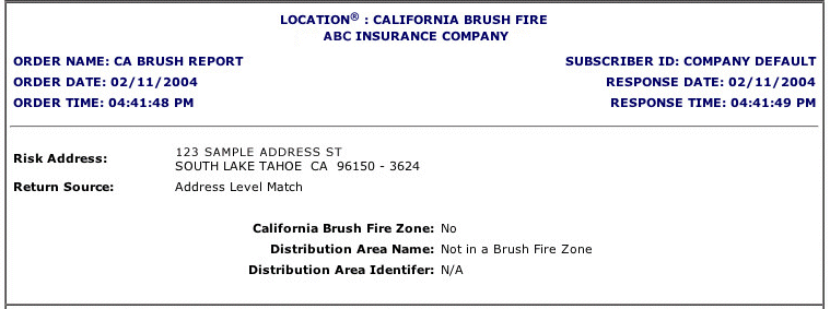
The LOCATION® California Brush Fire Report lets you verify whether a risk is located within a designated hazardous brushfire zone.
Only abbreviated reports are available for this service.
The California Brush Fire Report provides the following information:
|
Risk Address |
The address used to match against the database. |
|
Return Source |
Shows whether the match is on an address level or a ZIP-Code level. |
|
Identifies if the risk address is located in a brushfire zone.
|
|
|
Distribution Area Name |
Displays the name of the hazardous brushfire area. For risks located beyond brushfire areas, displays a message indicating that the risk address is not in a brushfire zone. |
|
Distribution Area Identifier |
Displays a two-digit/two-letter code identifying different hazardous brushfire areas. Displays "N/A" for risks located beyond those areas. |